Visitor guide / Rash Arang procession routes
NABADWIP • RASH YATRA

Rash Arang procession routes

View the archival tourist guide map and exploratory neighbourhood route concepts.

These coloured circuits are PLANNING CONCEPTS only—not authorised Arang routes or live road closures. The 1994 circular procession is discussed in the supplied history, but current festival routing requires confirmation from Nabadwip Police and Municipality. Do not use these maps for crowd control or emergency navigation.
MAP ARCHIVE

Original Rash visitor guide map

This illustrative city map is included in page 5 of the Rash souvenir PDF. It is not an official current road closure or Arang permission map.
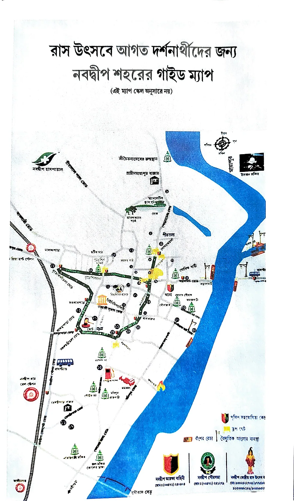
Archived Bengali guide map of Nabadwip town from Rash souvenir PDF
ROUTE CONCEPTS

Colour-coded route proposals

A · Poramatala Heritage Circuit

Porama Temple→Buro Shiv Temple→Nabadwip Municipality→Radhabazar More→Porama Temple

B · Dandapanitala Circuit

Dandapanitala More→Mangal Chandi Temple→Nabadwip Municipality→Radhabazar More→Dandapanitala More

C · Malancha Para Circuit

Malancha Para More→Nabadwip Municipality→Panchmatha More→Ram Sita Para More→Harisava Para More→Malancha Para More
Click any place to open navigation in Google Maps. Allow mobile location permissions only if you choose.